
Lower Providence Neighbors by Block Source
Different public sources answer different block questions. The tax map can show parcel geometry near a focal address. The property system can supply an individual parcel record after an address or parcel search. Recorder entries show transaction parties and chronology, while the formal state Street and Walking List products have controlled access. Township records and public organization listings can provide a community layer. None should be used to infer every person in a household.
| Source | What It Shows About a Block | Access |
|---|---|---|
| County interactive tax map and ArcGIS parcel service | Nearby parcel geometry and visual spatial relationship | Map visualization only; not a survey and not a household list |
| Montgomery County Property Records | Individual parcel and address record for each selected lot | Address or parcel input; public owner-name starting search is disabled |
| Recorder Public Access System | Recorded transaction parties, dates, and property-document chronology | Account and image-access rules apply; title party is not necessarily an occupant |
| Pennsylvania Street or Walking List | Authorized voter information by street in the requested product | $20 request, statutory-use certification, and privacy limits |
| Township permit or code file | Address-specific development or compliance record if releasable | Targeted written RTKL request; no online public search found |
| Township Resource Directory | Public business and organization contacts in the community | 394 public listings; not a resident or member directory |
A record about a parcel is not a statement about a household. The County’s property site removed owner-name starting searches, and a recorded deed party may be an owner, trust, estate, lender, or other transaction participant. Keep those distinctions in the notes from the start.
Note: Each block source has a different purpose, and no single one establishes a complete or current list of everyone at an address.
Map Lower Providence Neighbors Parcel First
The defensible method is visual adjacency, one parcel at a time. Official GIS material confirms parcel linework and spatial-relationship use, but the research did not verify an automated neighbor button, radius tool, buffer tool, or measurement label in the live viewer. Do not assume one exists. Start from the focal address, write down its parcel ID, use the map to identify parcels that appear directly adjacent, then look up each selected property separately.
- Search the focal street address in County Property Records and save the parcel ID and municipality.
- Open the tax-map location or the official parcel service and view the parcel around that identifier.
- Note only visually adjacent parcels from the map, without declaring a legal boundary.
- Run a separate address or parcel query for each selected lot.
- Use Recorder entries for a dated title trail where a property-record result needs context.
- For the broader record chain along a named street, use the dedicated street-address process.
The official Montgomery County parcel service is the visual starting point for this method.
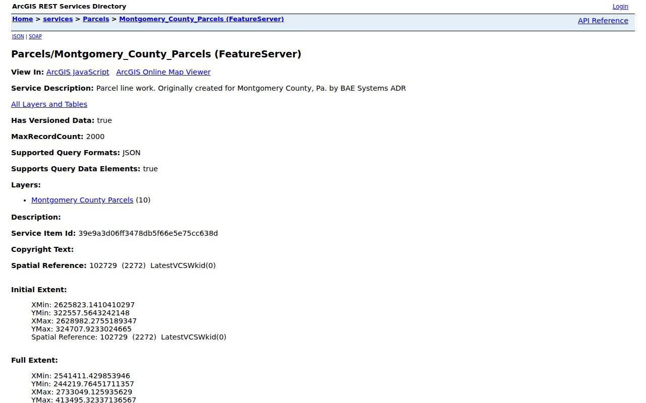
The service supports parcel context. Each adjacent lot still needs its own property or title record, and the map is not a substitute for a survey.
Lower Providence Neighbors Map Limits
The County says its interactive tax map helps users understand spatial relationships, while a licensed survey controls true boundary placement. A visual touch on the map can guide which parcel to inspect next. It cannot establish that two parcels legally share a line, determine an easement, define a radius, or identify a household. The research also did not verify a live map buffer or automated neighborhood-selection function, so descriptions of those features would be unsupported.
Map labels need context as well. Lower Providence’s records geography includes Audubon, Collegeville, Trooper, Eagleville, Yerkes, and Evansburg, and nearby postal labels can appear in county material. Retain the property address, municipality, postal city, parcel ID, and map view together. A postal city by itself does not settle the Township location or a precinct relationship.
Lower Providence Neighbors Through Recorded Deeds
The Recorder Public Access System can add transaction chronology to a selected parcel. Its search tools support such anchors as grantor or grantee, address, parcel ID, document number, subdivision, plan reference, and recorded date. The index reaches back to 1784 according to the Recorder, but remote document images are separately controlled. An account is required for the system, and image access has subscription or office-copy routes.
A deed answers a narrow question: which parties recorded a property transaction and when. It does not show every person who lived there. Read the legal description, parcel reference, recorded date, and party role before connecting a title record to a block. A seller may become an earlier grantee in the chain, which is useful for property history but still does not create a current-neighbor roster.
For an address-by-address record trail beyond the immediate block, use the Lower Providence Township street address directory instead of extending a parcel map into a whole-street household claim.
Note: A recorded title party can explain property chronology, but only a separate, dated record may support an inference about a household.
Lower Providence Neighbors and Voter Lists
Pennsylvania has a public individual registration-status service and separate formal voter-list products. The individual tool is for a voter’s registration status, not an open neighborhood search. The controlled Street List includes name, residential address, mailing address, party, and active or inactive status. The Walking List is a street-oriented version without mailing address. A request for either requires the Department of State process, a $20 fee, and an attestation that the statutory use restriction will be followed.
There are boundaries even in the authorized products. Ballot choices are never included. A full export can show participation dates or elections, not selections. Records are updated as registrations, transfers, deaths, moves, and cancellations are processed, so a status is not proof that someone left a particular address on a particular day. Pennsylvania’s Address Confidentiality Program and the list rules also mean a Street or Walking List cannot be assumed to enumerate every household.
Use the formal Pennsylvania voter-list request form and select only the lawful product needed. Montgomery County Voter Services can provide county-specific guidance.
Lower Providence Neighbors Community Contacts
Community organizations are a different layer from parcel and voter records. Township documents identify Providence Greene Homeowners’ Association in a 2023 resolution and Rittenhouse I and II Condominium Association, Inc. in a 2025 resolution concerning a Township-owned Audubon parcel. These are verified association references in Township material. They do not establish a publicly available member roster or current membership for either group.
| Providence Greene Homeowners’ Association | Named in a 2023 Township Board resolution. No public roster was located. |
|---|---|
| Rittenhouse I and II Condominium Association, Inc. | Named in a 2025 Township resolution. No public roster was located. |
| Community Library and Friends | Public organization and participation contacts, not patron or member records. |
| Township boards and commissions | Official and appointed contacts in public agenda material, not a neighborhood roll. |
A Township MS4 report notes that associations can be a way to contact residents through board meetings, newsletters, and social media. That is an outreach observation, not permission to infer membership or publish personal contact details.
Lower Providence Neighbors Public Community Layer
The Lower Providence Township Resource Directory is the documented public community layer. It reports 394 current business and organization entries and displays public-facing names, addresses, phone numbers, websites, and paginated search results. It can help identify an institution or service near a locality, especially where Audubon, Eagleville, or Collegeville labels overlap. It is not a database of private residences, association members, or neighbors.
The same boundary applies to the Township civic directory, boards, agenda materials, and library contacts. They show public organizational or official information. Use them to reach a public-facing organization, not to construct a resident roster from indirect references.
The Township Resource Directory screen shows its filterable public listings.
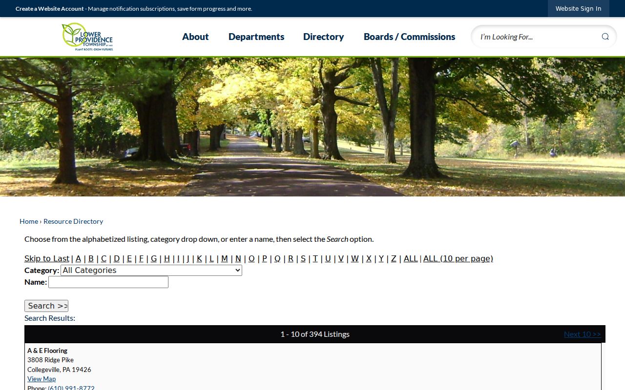
Its public organization and business results are useful local context, but they should never be recast as information about private household members.
Note: The Resource Directory lists public organizations and businesses, not association members, private residents, or household relationships.
Lower Providence Neighbors Official Record Comparison
Official sources are narrow by design. That makes their limits visible: the map shows parcels, the property system begins by address or parcel, the Recorder shows recorded transaction parties, and voter lists have controlled statutory access. Commercial neighbor-lookup categories may combine older public data, but they do not replace the current custodian or solve owner-versus-occupant ambiguity. Verify a fact with the office responsible for the record.
| Official record route | Commercial neighbor-lookup category |
|---|---|
| States the record type, custodian, access limits, and what the record can prove | May combine data of uncertain date or source; no substitute for a County or state record |
| Lets a user compare parcel ID, document date, legal description, and official status | Can blur owner, past address, and household relationships |
| Provides correction or verification channels with the actual record holder | Does not change the underlying County or state record |
This comparison supports a simple rule: map first, inspect the named official source second, and avoid conclusions that go beyond the evidence.
Lower Providence Neighbors Privacy Boundaries
Some information should not appear in a block search. Utility, delivery, medical, school, juvenile, sealed, adoption, and motor-vehicle information have separate protections. Pennsylvania’s Address Confidentiality Program can provide an alternate legal mailing address for eligible participants in government and related records. The program is part of a safety plan, and no record search should attempt to work around it.
Use Lower Providence neighbor records for civic curiosity, property context, reconnecting through appropriate public channels, and confirming a record with its custodian. Never use an address, map, public listing, or voter record to watch, stalk, harass, threaten, or harm anyone. If a record appears wrong, contact the actual County, state, or Township custodian rather than republishing it.